Colorado wildfires: Containment increases on Western Slope fires
Published in News & Features
DENVER — Firefighters battling wildfires across Colorado’s Western Slope are making gradual progress slowing fire growth and increasing containment, officials said Saturday.
Four of the state’s actively growing wildfires reported minimal growth Friday into Saturday, with afternoon rain helping fire crews on Colorado’s largest wildfire, the 15,413-acre Turner Gulch fire near Gateway.
Fire crews increased containment on the 2,274-acre Sowbelly fire to 50% as of Saturday morning, according to federal fire maps. The fire is burning in the Dominguez Escalante National Conservation Area near Delta.
The wildfires, four of which ignited in a lightning storm last week, have burned more than 24,000 acres in western Colorado.
Another brush fire — the Cottonwood Flat fire — was reported Thursday afternoon south of I-70 between Rulison and Parachute, prompting evacuation orders for nearby residents. Fire crews held the perimeter at 310 acres Friday and made “good progress,” the Garfield County Sheriff’s Office said. Evacuation orders for County Road 309 were scaled back to a pre-evacuation notice Friday night.
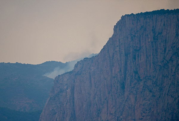
Turner Gulch fire and Wright Draw fire near Gateway
A Friday afternoon storm brought enough rain to dampen parts of the state’s largest wildfire, but the Turner Gulch fire is still burning along to the east and southwest edges near the Mesa County community of Gateway, fire officials said Saturday morning.
The fire grew 127 acres on Friday, bringing the blaze to 15,413 acres with 34% containment as of Saturday morning.
Although fire growth has slowed considerably since the flames roared across thousands of acres this week, firefighters are trying to figure out how to access the most remote sections of the Turner Gulch fire and nearby Wright Draw fire, which is burning on 448 acres on the opposite side of Unaweep Canyon.
Both fires are burning through a mix of extremely dry trees, brush and grass, including gambel oak, which fire officials said is particularly volatile.
“We don’t trust it, this fuel type,” Operations Section Chief Rob Powell said in an update video Friday. “Something squirrelly could happen, and it could run.”
Fire crews will continue building and strengthening fire lines with bulldozers, hand tools and strategic burning, fire officials said Saturday morning. Crews are flying over the most treacherous terrain on both fires to try to figure out a containment plan.
The Mesa County Sheriff’s Office lifted some evacuation orders Friday afternoon, and homes along Colorado 141 are now on pre-evacuation status. Sheriff’s officials also issued a pre-evacuation notice for private land within the Uncompahgre National Forest from Forest Road 406 to 409. Areas near the Divide Forks Campground and Casto Reservoir are still under mandatory evacuation, according to an evacuation map for the fires.
The two fires are still burning around Colorado 141, which is still closed between 7.40 Road and 16.10 Road at mile marker 124, according to the state Department of Transportation.
Deer Creek fire near Paradox
The wildfire in Utah and Colorado has burned 15,892 acres as of Saturday morning, with 17% contained — up from 6% Friday. While most of the fire has burned across eastern Utah, more than 1,800 acres of Colorado land have been torched.
Federal maps show the east edge of the fire is burning along Montrose County Road T2 and County Road U2, about 3 miles west of Paradox.
Fire crews continue to focus on building dozer lines west of Paradox to create a fire break around the community, officials said Saturday.
There is a community meeting at the Paradox Community Center, 21665 600 Road, at 6 p.m. Saturday, Utah Fire officials said. The meeting will focus on evacuation zones in the Paradox Valley.
On Friday, officials wrote that firefighters “made excellent progress” on Thursday on the north and east sides of the fire, and some residents in Utah began returning home.
The fire is creeping and smoldering along a 2-mile stretch of public land in Colorado, and firefighters may be helped by cooler weather and isolated showers Saturday.
South Rim fire near Montrose
More than 500 firefighters and experts responding to the South Rim fire in Black Canyon of the Gunnison National Park kept the fire from making any large runs Friday, with the fire’s footprint growing just 27 acres as of Saturday morning.
The lightning-sparked blaze is now burning on 4,251 acres in Montrose County and containment remains at 14%, fire officials said in a Saturday morning update.
Fire crews are focused on building and strengthening fire lines by removing vegetation, extinguishing hot spots and strategic burning.
When weather allows, pilots will use drones to drop pingpong-size balls of chemicals to ignite small fires around the perimeter to build fire lines. Using drones limits the risk to firefighters, officials said.
The fire has damaged or destroyed several buildings and other infrastructure in the national park, including the facility management building, Western National Parks warehouse, welding shop, some heavy equipment and the South Rim campground.
The national park is closed to the public until further notice and all campground reservations have been canceled for the rest of the year. None of the previously issued evacuation orders has been lifted, and several areas west, south and southeast of the fire — including the Bostwick Park area — remain under evacuation orders, according to the evacuation map.
Colorado 347 is remains closed at the junction of U.S. 50.
Blue Mesa Reservoir is closed west of Middle Bridge, and the Lake Fort Boat Ramp is closed for boat launches.
The Curecanti National Recreation Area remains open to the public.
©2025 MediaNews Group, Inc. Visit at denverpost.com. Distributed by Tribune Content Agency, LLC.


Comments