What will super El Niño mean for Puget Sound's already warming waters?
Published in News & Features
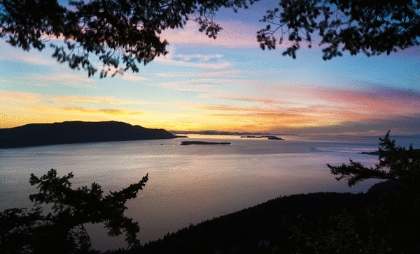
The Puget Sound region is heating up; there’s no doubt about it.
The years 2025 and 2026 saw warmer-than-usual temperatures across Western Washington, from Olympia to Bellingham. It’s not just here. NOAA recently reported that 2026 was the warmest summer on record for the contiguous United States.
And not just in the air. Puget Sound’s waters are warming as well.
Jan Newton is executive director of the Northwest Association of Networked Ocean Observing Systems (NANOOS), an agency that tracks ocean data in the Pacific Northwest. Newton told The News Tribune on Tuesday that water temperatures have been warmer than average in Puget Sound for a couple of years now. There are a number of reasons for it.
An incoming Super El Niño stands to warm things even more. Warmer weather = warmer waters
Last month, Vashon Island local Mary Singer became the first person to swim around the island, and she did it without a wetsuit. While swimming, her team recorded near-surface temperatures as high as 65 degrees, 7 to 10 degrees above normal.
She reported to The News Tribune at the time that it was “quite pleasant.”
On Tuesday, Newton told The News Tribune that she wasn’t surprised by that story.
“August was a couple of degrees Celsius above average,” Newton said. “And that’s at 4 meters depth. Surface temps would even be more, but our sensors don’t go up that high.”
The reason why the water temps are higher, Newton says, is because the air temps have been higher, particularly last winter, in which the area saw its hottest December on record.
NANOOS has been looking at what she calls “heat fluxes” that come from the sun in both short-wave and long-wave radiation.
“The shortwave radiation indicates sun,” Newton says. “The heat fluxes in late 2025 showed very high shortwave radiation, indicating sunnier-than-average heating during fall. And then we had much higher long-wave radiation in winter, which indicates clouds acting as insulation. The clouds trap the heat.”
Newton says those two factors are primarily to blame for the warming trend in our region: rising solar radiation, followed by cloudiness.
“You heat it, and then you put a blanket on top of it,” she explains. “The clouds retained heat in our region throughout 2025-2026. As a result, Puget Sound temperatures are warmer. We’re seeing temperature anomalies between 1 and 2 degrees Celsius (multiply by 1.8 for Fahrenheit). That’s significant. That’s in the Puget Sound itself.”
All symptoms of long-term climate change.
Warmer Puget Sound waters reduce oxygen levels and stress marine life. Last month, dozens of fish washed up dead on the beaches of Hood Canal due to lack of oxygen in the water.
“This year the oxygen is lower than what I have seen,” Newton told KING 5 News at the time. “It is anoxic, which means it is at zero.”
The species affected in the August Hood Canal event were flounders, ratfish, lingcod, shrimp, and octopi, but many more marine species stand to be affected by warming waters because a decrease in oxygen can bring an increase of invasive species that can live in lower oxygenated water.
Warmer and lower oxygen water can also disturb bull kelp forests, and increase harmful toxic algae blooms that sicken marine mammals and birds. Warmer waters and declining oxygen can also bring in more jellyfish, which multiply quickly and can outcompete native species for food.
A recent NANOOS report written after the Hood Canal event in August says higher temperatures also caused organisms to respire faster, which contributed to the oxygen deficit (along with warmer water). Super El Niño
NANOOS has been tracking the Super El Niño anomalies, which you can see on its website. Newton says a massive Kelvin wave is making its way north and is currently off the coast of California. A Kelvin wave, unlike a regular swell or local wave, occurs beneath the surface and can stretch for thousands of miles, raising the level and temperature of the water.
“It’s not here yet, but it will be,” she said.
Recent warming trends can’t be blamed on a Super El Niño, but upcoming fall and winter temperatures possibly could be.
“The fall will be warmer than average,” Newton says. “So high temperatures will persist because our weather is getting the signal from the ocean.”
Deputy state climatologist Karin Bumbaco agrees.
“This winter, we are expecting to see warmer-than-normal air temperatures, and that’s across all of Washington state,” Bumbaco told The News Tribune over the phone on Thursday. “That tends to influence the water. Right now, our seasonal forecast models are predicting strongly above-normal temperatures. From October through December, and then again January through March.”
How much rain and snow we could get is less certain.
“We usually expect to see drier than normal precipitation during El Niño years,” Bumbaco says. “This year is slightly different because of how strong this El Niño is. There’s a little bit more uncertainty in what precipitation will be over the following winter.”
Bumbaco went on to explain that El Niños start in the tropical Pacific. Warmer weather there influences thunderstorms and how they move back and forth across the equator. She says an El Niño has downstream effects both where it happens at the equator and globally and impacts our weather by affecting global circulation patterns.
That usually means warmer-than-average temperatures in Western Washington and less snowpack on April 1. But there’s a lot of uncertainty this year because this El Niño event is very strong in the tropical Pacific. There haven’t been many like it in the past.
“The few that we’ve seen have actually been pretty good news for us, precipitation-wise,” she said. “Some of them were wetter than normal and had normal snowpacks. And between that and what our seasonal forecast models are showing, there’s just a lot of uncertainty in how the precipitation will play out this time. The slightest change in weather patterns can cause that precipitation that’s headed for California to come up the coast and impact Washington and Oregon.”
Another ingredient to add is warming ocean waters making their way into the Puget Sound.
“There has been some work that has shown that if there are above-normal sea temperatures off the coast of Washington, it can actually influence our temperatures in Western Washington and make them warmer than normal as well.” Tidally mixed
Puget Sound waters are what Newton calls “tidally mixed,” which is why they’re always so cold. Cold water from the Pacific Ocean flushes into Puget Sound from the Strait of Juan de Fuca and replaces any sun-heated water with fresh, cold-water tides. Part of the reason why the tides are so effective is because Puget Sound has a lot of underwater mountains, hills and features. When water flows over those features, it causes turbulent mixing.
Different areas of Puget Sound have different degrees of flushing. Flushing Hood Canal, for instance, can take a year. So when tides come in and out, they aren’t flushing everything.
“Hood Canal takes a long time because it’s long and narrow,” Newton explained. “There are other places that flush quickly, like the main basin of Puget Sound. That flushes quickly because there’s no obstruction; there’s just this big chute that goes back and forth.
Tidal mixing is really strong in places with underwater mountains and narrow chutes. Places like Admiralty Inlet, the Tacoma Narrows, Deception Pass, and there’s an underwater mountain in the northern part of Hood Canal, Newton says. “Those are places where you’ll see tide rips that are going to be crazy. They trap and hold onto the water.”
The calmer areas of Puget Sound, places where the water moves quite a bit slower, benefit most from the solar heat of the sun and insulation from the clouds.
Like two giant mirrors reflecting at each other, warmer Puget Sound weather is heating our waters, and warmer water off the coast is warming our air. It’s affecting everything in the Puget Sound, from marine life to weather. Climatologists and oceanographers like Karin Bombaco and Jan Newton will continue to study why.
©2026 The News Tribune (Tacoma, Wash.). Visit at TheNewsTribune.com. Distributed by Tribune Content Agency, LLC.






Comments