A record number of tornadoes formed in central NC this week
Published in News & Features
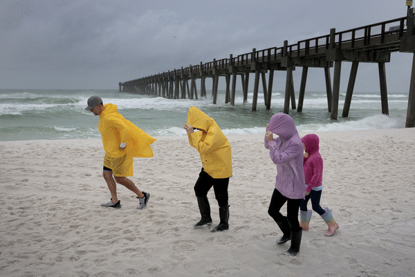
Remnants of Hurricane Isaias brought a record number of tornadoes to central North Carolina, with one of the strongest tornadoes traveling more than 5 miles.
There were 13 tornadoes across the state on Sunday, Oct. 11, with nine of those in the central part of the state and under the National Weather Service’s Raleigh office’s coverage area.
“Nine total tornadoes in a single day actually ties for the most tornadoes to occur in a single day in our own forecast area on central North Carolina, and that’s tied with 2011 and 1992,” said Andrew Swiggett, a meteorologist in the Raleigh office. “So pretty phenomenal event on Sunday.”
Emergency management officials and meteorologists with the National Weather Service have spent the days since Sunday surveying damage to better categorize the tornadoes.
Here’s where the tornadoes hit in central North Carolina and details of each tornado, according to the National Weather Service’s Raleigh office:
— Candor, Montgomery County: This EF-2 tornado began at 10:14 a.m. lasting just a minute. It traveled 0.38 miles near Brutonville Road and Interstate 73. There were no reported injuries or deaths. The estimated wind peak was 115 mph.
— Bonnie Doone/Fayetteville, Cumberland County: This EF-2 tornado began at 11:56 a.m., lasting until 12:05 p.m. It traveled 5.3 miles damaging roofs, starting at the intersection of Skibo and Morganton roads before ending near Interstate 295. There was one reported injury, no deaths, and the estimated wind peak was 115 mph.
— Jordan Lake, Chatham County: This EF-1 tornado started at 12:02 p.m., lasting a minute and traveling 1.07 miles near Beaver Creek Road. There were no reported injuries or deaths. The estimated wind peak was 100-107 mph.
— Linden, Cumberland County: This EF-1 tornado started at 12:23 p.m. and continued until 12:25 p.m., traveling 1.18 miles near Glenmont Creek Place, Hungry Creek Drive and Rainy Beck Way. There were no reported injuries and deaths, and the estimated wind peak was 105 mph.
— Carpenter, Wake County: This EF-1 tornado started at 12:29 p.m. and lasted just a minute, traveling 0.37 miles near Morrisville Parkway and Louis Stephens Drive. There were no reported injuries or deaths, and the estimated wind peak was 95-100 mph.
— Clayton, Johnston County: This EF-0 tornado started at 1:15 p.m. and ended at 1:22 p.m., traveling 3.33 miles near Clayton Boulevard and NC Highway 42. There were no reported injuries or deaths, and the estimated wind peak was 85 mph.
— Perry Creek, Wake County: This EF-1 tornado started at 1:12 p.m. and lasted five minutes, traveling 2.51 miles first in the Stone Ridge neighborhood, south of Interstate 540, and traveling north toward the Neuse Crossing neighborhood. The estimated wind peak was 107 mph. There were no reported injuries or deaths.
— Harrells, Sampson County: This EF-0 tornado started and ended at 1:25 p.m., traveling 0.18 miles north of Wilmington Highway in Harells. There were no reported injures or deaths. The estimated wind peak was 75 mph.
— Louisburg, Franklin County: This EF-1 tornado started at 1:42 p.m. and lasted until 1:47 p.m., traveling 1.93 miles southwest of Louisburg, crossing NC-56 near Timberlake Road. There were no reported injuries or deaths. The estimated wind peak was 110 mph.
The four other tornadoes outside the Raleigh office’s coverage area were one each in Jones, Duplin, Bladen and Columbus counties.
What is the EF Scale for tornadoes?
Tornadoes are assigned a rating from the National Weather Service using the Enhanced Fujita Scale or EF Scale based on estimated wind speeds, measuring a 3-second wind gust, and damage.
Here’s what the ratings mean, according to the National Weather Service:
— EF-0: 65-85 mph
— EF-1: 86-110 mph
— EF-2: 111-135 mph
— EF-3: 136-165 mph
— EF-4: 166-200 mph
— EF-5: over 200 mph
Tornado watch vs. warning
The National Weather Service issues three alerts related to tornadoes.
— Tornado Watch: Weather conditions could lead to the formation of severe storms or tornadoes. Review your emergency plans, and identify where you would shelter in place if a tornado does form. The watch area can be large, covering several counties or states.
— Tornado Warning: A tornado has been sighted or indicated by weather radar, and there is imminent danger to life and property. People should move to an interior room on the lowest floor of a sturdy building. If in a mobile home, vehicle or outdoor, people should try to move to a more substantial shelter.
— Tornado Emergency: This is the highest alert for tornadoes. This means “a violent tornado has touched down,” with a “severe threat to human life and property, with catastrophic damage confirmed.”
_____
©2026 Raleigh News & Observer. Visit newsobserver.com. Distributed by Tribune Content Agency, LLC.






Comments