Tornado hits city of Pico Rivera amid powerful storm that brought flooding and mountain snow to Southern California
Published in Weather News
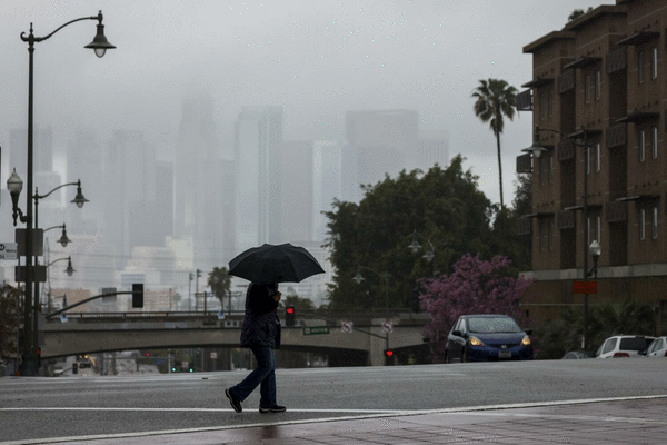
LOS ANGELES — A major storm continued to wallop parts of Southern California on Thursday morning, bringing evacuation alerts, fears of mudslides, heavy mountain snow and a tornado that snapped trees and damaged homes and cars.
Several flood and severe thunderstorm warnings — as well as winter weather advisories in the mountains — remained in effect Thursday morning as bands of heavy precipitation moved through, and were expected to continue shifting south through the day.
There were reports of some debris flows in burn areas as well as some scattered hail. Intense bursts of rain caused minor street flooding and several closures from southern Santa Barbara County down into Orange County. The Los Angeles Fire Department worked early Thursday to rescue someone stuck on a concrete alcove along the rising Los Angeles River in Boyle Heights.
Wind gusts were forecast to top 50 mph in some areas. In Pico Rivera, a tornado with wind speeds reaching 85 mph formed around 3:15 a.m. and traveled roughly a mile through a residential area of the city, according to the National Weather Service.
Debris littered streets in the area and several large trees were snapped on Glencannon Drive, a residential street where the tornado also damaged several vehicles and houses. No injures were reported.
The tornado, which didn’t last long, measured as the lowest level on the Enhanced Fujita Scale, a method used by meteorologists to rate a tornado based on estimated wind speeds and related damage. The twister was on the upper end of the lowest rating, said Ariel Cohen, a meteorologist with the National Weather Service in Oxnard.
“While brief, it was still damaging,” Cohen said.
In the mountains around Los Angeles, San Bernardino and Riverside counties, several inches of snow had piled up by Thursday morning, triggering school closures in the area. The San Bernardino Fire Department said it had reports of several power outages.
The major ski resorts reported up to 10 inches of fresh powder and snowflakes still falling. Mountain High received between 10 and 13 inches of snow, while Mount Wilson received 4 inches. Gorman, a town located along the Grapevine, received an inch of snow, according to the weather service.
“It’s safe to say this storm was the biggest snowmaker,” Ryan Kittell, a meteorologist with the National Weather Service in Oxnard, said of the systems to hit Southern California this winter.
Besides major delays in the morning commute, forecasters said the worst of the storm had made its way through Los Angeles County by around 8 a.m., though residents south and east should remain on high alert.
“The main storm passed, we’re kind of in a showery regime (the rest of the day), with off and on showers and maybe some thunderstorms,” said Mike Wofford, a meteorologist with the National Weather Service in Oxnard. “It’s moved into San Bernardino and Orange County.”
In Pico Rivera, residents were jolted awake early Thursday to the sound of trees falling on cars and into homes and strong winds from the tornado tossing around outdoor furniture.
A brick wall collapsed in Edgar Reynoso’s backyard, but the rest of his home was relatively untouched by the powerful winds.
“I heard like a big old bomb. It’s my first tornado,” he said, accessing the collapsed wall. “It’s my first time living through it and ... it was pretty scary.”
Nearby, Cuba Garcia thought somebody was hitting the side of his home overnight, but when he looked at his security camera he realized that the strong gusts had flipped a metal canopy from his backyard onto his roof.
As the sun came up he was trying to figure out how he would get the structure down. After the rain stopped he planned to climb onto the roof with some friends and try to break apart the structure, which sat on his home like an upside down turtle.
“Earthquakes we can go through in our daily lives and be fine, but a tornado? Tornadoes are just something totally different,” Garcia said.
Much of the tornado damage was centered along Glencannon Drive. By midmorning Thursday, crews were busy working in the area to remove downed trees as residents took in the unfamiliar scene.
The wind was howling so loud outside Carlos Aguilar’s home that his dog woke him up. He heard a loud thump and when he looked out his window he saw that a 75-foot pine tree had fallen into his front yard, narrowly missing his front door.
His 2018 Hyundai Elantra wasn’t as lucky. The car remained under the tree several hours later.
“I’ve never seen anything like this,” Aguilar said.
In the Santa Ana foothills near Rancho Santa Margarita in Orange County, officials closed Trabuco Canyon Road, after rain swept rocks, tree limbs and several inches of mud across the roadway. That area remained under an evacuation order.
Evacuation warnings and orders were also issued for Los Angeles communities near the Eaton, Palisades and Sunset fire burn zones ahead of the rain. Several schools in the Malibu area also canceled classes Thursday due to road closures and safety concerns from the storm, with many neighborhoods under evacuation warnings, according to the city.
In the Palisades burn scar, the Getty Villa area, the Highlands, the Bienveneda area near Temescal Canyon Park, Rivas Canyon/Will Rogers State Park, Mandeville Canyon above Tanners Road, Old Ranch Road and Rustic Creek were under evacuation warnings starting Wednesday morning.
Areas east and south of Runyon Canyon in the Sunset fire zone are also under an evacuation warning. In the Hurst fire area, an evacuation warning has been issued for Olive Lane in the Oakridge Mobile Home Park, according to the Los Angeles Fire Department.
The evacuations are expected to last until 6 p.m. Thursday, according to the Los Angeles Fire Department.
Malibu also issued evacuation warnings.
The areas include Carbon Canyon, Carbon Beach East, La Costa Beach/La Costa (hillside), Las Flores Creek, Las Flores Mesa, eastern Malibu, Big Rock, Las Tunas Beach, Topanga Beach Road, Carbon Beach Terrace, Carbon Beach, Rambla Pacifico, Carbon Beach West/Malibu Beach, Sweetwater Canyon, Sweetwater Mesa, Serra Retreat, Malibu Creek, Cross Creek, Malibu Colony, Civic Center, Malibu Knolls, Malibu Road, Malibu Country Estates, Puerco Canyon and Piuma Road.
In the Eaton fire burn scar, officials warned residents to prepare to leave their homes ahead of the storm.
The city of Sierra Madre issued mandatory evacuation orders for homes directly below the Sierra Madre and Lannan debris basins. Evacuation warnings have been issued for other hillside-adjacent neighborhoods in the community. Those evacuations will remain in effect through 6 p.m. Thursday, according to the city.
Evacuation warnings were also issued for homes near the San Gabriel foothills in Altadena.
Authorities visited properties in areas that are at especially high risk to issue specific evacuation orders ahead of the storm, according to the city of Los Angeles.
“The heaviest rain has moved out of the LA area,” Los Angeles Mayor Karen Bass wrote Thursday morning on X. “Please stay vigilant — especially in burn areas — as periods of heavy rain will continue throughout the day.”
While more rain is expected, this week’s back-to-back storms have already delivered a significant dose of moisture to Southern California.
Between Tuesday and 5 a.m. Thursday, Beverly Hills saw 1.25 inches of rain. Downtown Los Angeles received 1.19 inches, Woodland Hills got 1.66 inches and the Eagle Rock Reservoir received 1.81 inches, according to the weather service.
Rain totals were even higher in the Los Angeles County mountains with the Cogswell Dam receiving 3.58 inches and Crystal Lake seeing 3.07 inches over the two-day period.
In Orange County, Lower Silverado Canyon received 0.91 of an inch of rain in a six-hour period that ended at 5 a.m. Thursday. Coto De Caza received 0.75 of an inch and Corona del Mar got 0.71 of an inch, according to the weather service.
©2025 Los Angeles Times. Visit at latimes.com. Distributed by Tribune Content Agency, LLC.


Comments