Atmospheric river storm slams into Southern California amid evacuation and flood warnings
Published in News & Features
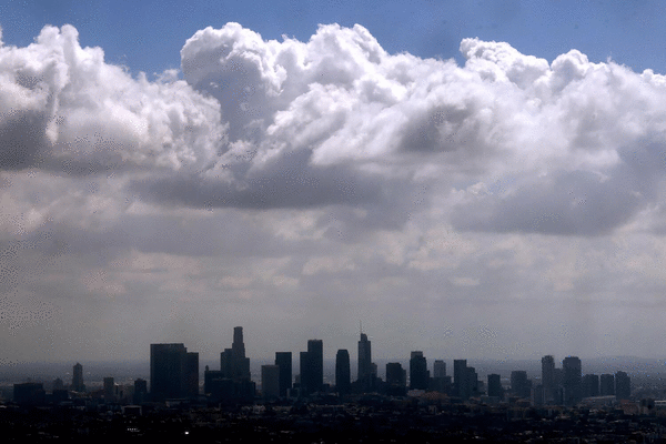
LOS ANGELES — An atmospheric river hit Los Angeles in the early hours of Tuesday morning, bringing with it scattered downpours, powerful winds, fears of flooding — and even some tornado warnings to the Central Coast.
Evacuation warnings have been issued in areas ravaged by January’s firestorm — including the burn scars from the Palisades fire, the Eaton fire in Altadena, the Hurst fire in Sylmar and the Sunset fire in the Hollywood Hills — which are at a high risk of debris flows.
As of 8 a.m., the storm was on its way to the Palisades fire burn scar, with rainfall rates expected to be intense enough — 1 to 1.5 inches per hour — that the National Weather Service issued a flash flood warning for the area, said John Dumas, meteorologist with the Weather Service. Burned soil repels water instead of soaking it in, so it takes less rain to trigger damaging flooding and debris flows, he said. The warning also encompassed the Franklin fire burn scar in the Malibu area.
The Weather Service also issued a severe thunderstorm warning for parts of west central Los Angeles County, until 9:30 a.m., saying that a line of thunderstorms from Thousand Oaks to Westlake Village had the potential to generate hail and 60-mph wind gusts that could damage roofs, siding and trees.
A flash flood watch is in effect for most of the county through Tuesday afternoon, with the heaviest rain predicted for Tuesday morning. The main impacts to Los Angeles are expected between 9 and 11 a.m., Dumas said.
The Weather Service warned that the “rare and very potent storm system” could fuel mudslides, thunderstorms, hail, and gusty winds capable of knocking down trees and power lines.
The storm began in earnest Tuesday morning, dropping rain across Los Angeles and knocking down trees near Balboa Avenue and the 101 freeway, according to the National Weather Service.
“If outdoors, consider seeking shelter inside a building,” the Weather Service warned in statement. “Torrential rainfall is also occurring with this storm and may lead to localized flooding. Do not drive your vehicle through flooded roadways.”
As the storm moved through San Luis Obispo County around midnight, it dropped up to 2.5 inches of water per hour and prompted the Weather Service to issue a couple of rare tornado warnings for areas including Pismo Beach, Nipomo and Oceano. It wasn’t immediately clear whether a tornado formed.
As the storm moved down into Ventura County’s mountains later Tuesday morning, some higher-elevation areas saw rainfall rates as high as 3.5 inches per hour, Dumas said. The Weather Service is aware of reports of downed trees, rocks and debris, he said.
Before arriving in Southern California, the wintry storm swept through Northern and Central California, where it dusted the Sierra with the season’s first major accumulation of snow, caused flight delays at San Francisco Airport, and generated a whirling column of air and mist over Monterey Bay. By Monday evening, rain fall totals in the Bay Area ranged from around 0.5 inches to 2 inches, according to the weather service.
The storm brought road flooding across the Bay Area.
In L.A. County, the weather service predicts total rainfall of 0.75 to 1.5 inches in coastal and valley areas and from 2 to 4 inches in foothill and mountain areas. The storm system will also cause regional temperatures to plunge several degrees below normal.
Flash flood warnings are in effect for much of Ventura County, parts of northern Santa Barbara County and inland Orange County, with residents in burn scars also warned to be prepared for debris flows.
“Peak rainfall rates of 0.33 to 0.66 inches per hour will be common, which should be enough to cause plenty of minor road issues and heavy traffic for the Tuesday morning commute,” the weather services stated in its Los Angeles-area forecast. “Rockslides in canyon roads are nearly certain.”
Topanga Canyon Boulevard between Pacific Coast Highway and Grand View Drive was closed from 10 p.m. Monday until 5 a.m. Tuesday due to the predicted storm. This 3.6-mile stretch of highway is an ongoing work zone due to damage from the Palisades fire and previous winter storms.
City and county authorities worked to prepare vulnerable areas with sandbags on Monday, while law enforcement went door to door warning residents in burn scars about the risk of debris flows.
The Los Angeles Fire Department, in coordination with the state Office of Emergency Services, pre-deployed a 22-member strike team, a 27-member hand crew, a six-member urban search-and-rescue team and a 16-member swift-water rescue team to respond to potential debris flows.
Leaders urged residents to sign up for emergency alerts at NotifyLA.org and to pay close attention to evacuation warnings.
“As today’s storm intensifies, I cannot emphasize strongly enough the importance of heeding evacuation warnings and orders,” said L.A. County Board of Supervisors Chair Kathryn Barger in a statement Monday. “These alerts are issued to protect lives. Conditions can change quickly, and once debris flows begin, it may be too late for emergency crews to reach you.”
The weather service advised people to avoid outdoor activity, traveling on roads and parking near tall trees during the storm and to be prepared for possible power outages.
Lingering showers are expected to peter out by Wednesday evening, with drying and warming winds sweeping across the county that night. Southern California’s characteristically moderate climate should return by Thursday with pleasant highs in the 70s common across L.A. County.
___
©2025 Los Angeles Times. Visit at latimes.com. Distributed by Tribune Content Agency, LLC.


Comments