Another atmospheric river is headed to Western WA, but it won't be as bad
Published in News & Features
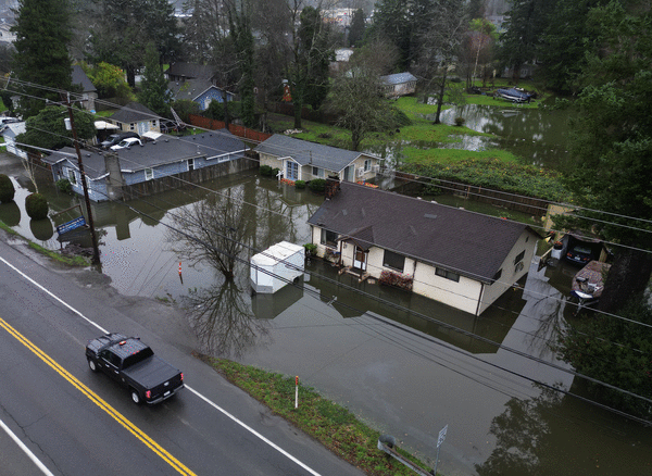
SEATTLE — As Western Washington reels from catastrophic flooding that swept the areas along major river valleys, another plume of moisture will arrive on Sunday, according to the National Weather Service.
An atmospheric river rolled into the region Monday, bringing devastating floods to several areas and hitting communities along the Nooksack, Skagit, Skykomish and Snohomish rivers hard.
Usually, atmospheric rivers aren't unusual, bringing mild showers and gray skies. This time, Seattle NWS meteorologist Anna Lindeman said unusually warm temperatures caused snow levels to rise so high that most of the moisture fell as rain, rapidly feeding rivers and worsening flooding. Some areas saw more than 12 inches of rain.
The new atmospheric river is slated to be more mundane, but, given the preexisting flooding, it may worsen river overflows and landslide risks.
I know that sounds very scary, but luckily, it's definitely not going to have as much moisture in terms of what we saw this week," she said. "It's going to be much weaker coming in, but it will probably cause a lot of area rivers to rise once again. We're not necessarily seeing any signals that it'll be nearly as bad as what we saw this week.
The next atmospheric river is only supposed to last a day or two.
Lindeman said the region will see drier but foggy conditions Saturday with a mostly dry morning and afternoon before showers roll in the evening. Temperatures will rise to 55 degrees at Seattle-Tacoma International Airport.
© 2025 The Seattle Times. Visit www.seattletimes.com. Distributed by Tribune Content Agency, LLC.


Comments